Tuesday, June 22, 2010

The Islands: Martha’s Vineyard and Nantucket

If you have a chance, visit the Vineyard and Nantucket, off the south coast of Cape Cod. They really are lovely, and quite different from one another ecologically. Martha’s Vineyard has lots of forests of deciduous trees—trees that shed their leaves in winter—providing deep shade for some of the roads and paths. Other areas are agricultural, or have green rolling hills and fields. In contrast, much of Nantucket has pine forests and sandy soils, and moors with low scrub. There also were some agricultural areas, but the overall impression is of a sunny, open landscape with intermittent spots of shade. Of course, both islands are surrounded by beautiful water, and have lots of great beaches.

We have been to Martha’s Vineyard before, so we restricted our tromps this time to Vineyard Haven, on the northeast side of the island. If you’ve been there, you know that Black Dog has a tavern (which has very good food but no alcohol, as Vineyard Haven is a dry town), bakery, clothing shops, and schooners. Chris got friendly with a couple of the dogs at Black Dog schooner, and we saw this Black Dog schooner sailing by. The dinghy dock is convenient to town and abuts a pretty park.


We went much farther afield on Nantucket. The first afternoon we walked the town, looking at the dock houses on the waterfront, and visited the Whaling Museum, which was fascinating. After dinner we hiked out to The Chicken Box, a bar with live music nearly every night, recommended by my brother, Frannie. The place was packed, though the show didn’t start until 10:30 pm, and the music was great. The next day we rented bikes and biked around quite a bit of the island. We had a picnic lunch at Sankaty Light, strolled around the settlement of Siasconset (prounounced ‘Sconcet) where there was a cool building with a sundial on the side, and napped on the warm sand at Surfside Beach. Our thighs (OK, Anne’s thighs) were feeling a bit wobbly at this point, so we took advantage of the nice FREE showers provided at the Nantucket Town Pier. A good time was had by all.

Wednesday, June 16, 2010

A Marine Biologist’s Mecca: Woods Hole, Massachusetts

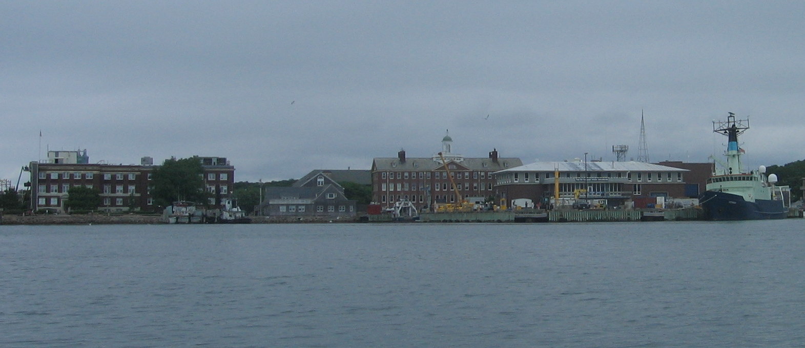
Woods Hole Oceanographic Institute (WHOI), National Marine Fisheries Service (NMFS), the Marine Biological Laboratory (MBL) – all familiar names and acronyms if you’re a marine biologist (that would be Anne). The waterfront is lined with research buildings, some quite beautiful, like this stone building. Research vessels, when they’re in port, are moored at the numerous docks. We saw the NOAA/NMFS vessel, Delaware II, being readied to head to the Gulf of Mexico to participate in research related to the BP oil spill. We caught up with Rich McBride, who used to work with Anne at FWRI, and now works at the NMFS lab here. We had a great dinner with Rich, his wife, Susan, and their daughter, Sarah, at their lovely home in Falmouth – thanks so much! Woods Hole also has lots of great restaurants. Pie in the Sky is a small restaurant/bakery with a pastry case that will have you drooling for one of everything. We walked a portion of the bike path that runs to Falmouth. The scenery was beautiful, from little harbors to tree-lined paths, and the smell of roses was everywhere.


While visiting Woods Hole, we anchored in Hadley Harbor, a beautiful protected little cove. The harbor abuts Naushon Island, a private island with lovely big houses, grazing horses, and an adorable little bridge over to another small island. Either the island residents or Naushon Trust, which owns the island, have installed mooring balls in the harbor that cruisers can use for free. Also, cruisers are welcome to land on adjacent Bull Island, which has a dinghy dock, a well-maintained picnic area, and a welcome sign. Quite a difference from some areas where all you see are no trespassing signs and fences!

Friday, June 11, 2010

Montauk, Long Island

Long Island, New York, this time, not Long Island, Bahamas. We’ve been making easy overnight trips up the coast: Willoughby Bay to Cape May, Cape May to Rockaway Bay (just west of Coney Island), and Rockaway Bay to Montauk. This is a terrifically protected harbor. A narrow channel leads into Lake Montauk, which originally was a landlocked freshwater lake, until the channel was cut to it. The guidebook says that holding here is poor, but we put out lots of scope and had no problem in a blow. Montauk touts itself as “The Fishing Capital of the World,” and there are many commercial fishing boats, as well as hundreds of sport fishing boats. Sailboats? A quick survey of the numerous marinas showed fewer than ten. Only one other sailboat showed up and anchored. A bit lonely after so many months of areas with mostly sailboats, and only a few power boats. But the anchorage sure is pretty, surrounded by marsh grasses and trees and nice houses tucked into the greenery. And when we went walking, there were flowers everywhere.

When a Bad Day Turns Good

Which is much better than the reverse. We pulled anchor about 6:00 am at Willoughby Bay, which is on the south side of the mouth of Chesapeake Bay, and headed out the well-marked channel. Well, you generally expect that a well-marked channel indicates that the shallows are OUTSIDE the channel. Not so! In the middle of the channel, not 50 feet from the end, we ran smack into a shoal. It was soft mud, but the wind and waves pushed us farther on, and we couldn’t motor or sail off of it. This was the bad thing. It was also a falling tide. This was worse. Finally we bit the bullet and called Towboat U.S. They couldn’t have been more polite or helpful, but before they could get a captain to call us back, a tug boat came out of the channel and offered to pull us off. This was a good thing. So our deepest thanks to the guys from Precor on the boat Chesapeake! Closer examination of the chart shows that a shoal is indicated in that area (why they don’t dredge it or move the marker to indicate the real channel, I don’t know), so we felt kind of dumb. But about an hour later, we heard a call to Towboat U.S. from a sailboat that had been anchored near us, aground in the same place. So it wasn’t just us.


But the day got even better, because we came across WHALES! There were just a couple, but they were close (close enough to make Chris nervous) and as big as the boat. They were just swimming along, paying us no mind. Anne was hoping for a breach, but they weren’t that energetic. That’s OK, because we were energetic enough for all of us, bopping around the boat, climbing the arch trying to get the best view and take pictures. This way more than compensated for the bad start in the morning!

Tuesday, June 1, 2010

This Is Not A Taste Test

OK, one unattractive feature about the Dismal Swamp is the water color. Much of the ICW in this area has waters dark with tannic acid, which is produced from decaying organic matter such as tree leaves. However, the Dismal Swamp water was really dark. For a comparison, we filled three glasses: filtered tap water, iced tea, and Dismal Swamp water. The filtered tap water in the picture above is obvious, and that’s what Bahamas water looked like (heavy sigh). Can you guess which of the other two contains the Dismal Swamp water and which contains the iced tea? I thought not! Actually, if the iced tea glass hadn’t had condensed water on it because it was cold, we might have ended up dumping the tea and drinking the swamp water.

The Dismal Swamp—Not!

At Albemarle Sound in North Carolina, the Intracoastal Waterway (ICW) splits in two for a while. The Virginia Cut route runs near to the coast. The Dismal Swamp route is farther west, running through the—you got it—Dismal Swamp. But really, do these pictures look dismal to you? Green trees, calm water, wild pink roses and white magnolia blossoms, birds singing, dragonflies standing guard on the life lines, and butterflies flitting across the deck, so close that they’d brush by us. It was pretty darn undismal. In fact, the only dismal thing we encountered was the too-warm, still nights when we had to put up all our screens or close the hatches due to the bugs. Otherwise, the days were terrific, even if you do have to motor the whole way. Also, the people were great. Halfway through there is a free dock at the Dismal Swamp Visitor Center, and the women in the center were wonderful. They showed us the book exchange, gave us loaner bikes to bike the trail, and told us how to get to the village of South Mills for an ice cream. The second day, we met Robert, the lock keeper at the Deep Creek lock, who is happy and friendly and blows a conch horn while you’re locking through. We gave him one of the conch shells we collected in the Bahamas because his were looking worn. The Dismal Swamp route is a bit longer than the Virginia Cut route, but it certainly was worth the extra time and effort.