Friday, December 24, 2010

Waderick Wells in the Exumas Land and Sea Park

Mr Mac in the long, thin mooring field (dark blue water) at Waderick Wells
The Exumas Land and Sea Park was established in 1958, and has been a no-take zone since the 1980s.  The ranger’s station and main mooring field is at Waderick Wells, a cool island with plenty of areas for snorkeling, hiking, and seeing hutias, indigenous rabbit-sized rodents that Anne thinks are adorable, but which her mother would hate because of their long hairless tails (Mom’s not a rodent fan).  There’s always work to be done, so we volunteered for a day again this year.  Along with another couple, we managed to pull a boat way up on the beach, take off the hardware so it could be painted, and remove the leaking gas tank by sawing off the deck.  This was actually the boat that Chris and I spent a day fixing and sprucing up last year, so it was kind of sad to see it disassembled, though we heard later on that they received a replacement tank and had it installed within a week – terrifically quick for this part of the world, where you have to wait for the mail boat to deliver stuff.  Boo Boo Hill has a cairn of driftwood on which cruisers have written or etched their names.  Chris scratched one out for Mr Mac to add to the pile.
Chris adding a "Mr Mac" plaque to the cairn on Boo Boo Hill

Ahhh, Back in the Exumas!


The water in the Exumas is just beautiful.  It’s so clear, you can literally see every blade of grass beneath you, even though the water may be more than ten feet deep.  The sand banks are brilliant, especially at night under a full moon, when they reflect the moon light and virtually glow.  The water’s still pretty warm, so although Chris wears his shorty wet suit in for snorkeling (no body fat to keep him warm), Anne’s still just wearing a bathing suit.  This picture was taken at Hawksbill Cay, a small island in the Exumas Land and Sea Park.

Berry Islands to Nassau

 We spent Thanksgiving in the Berry Islands (which is where the blue hole from our last posting was), then headed down to Nassau.  En route, we passed through a line of clouds with light showers, then it trailed us the rest of the way down.  At one point we saw two water spouts developing; one got long enough to stir up the water on the ocean surface, but both disassembled fairly quickly (yeah!).  But of course, you need rain to get a rainbow, and this one was a beauty.  You could see the entire arc, and at one end it there was a faint second rainbow.  We saw loads of cruise ships between Port Lucaya and Nassau, and there were three or four at dock in Nassau.  They’re so huge!—especially when you’re passing by on your own small boat.

Monday, December 6, 2010

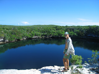
Blue Hole on Hoffman’s Cay


We anchored for several days between Devil and Hoffman’s Cays.  On Hoffman’s Cay, we walked to a blue hole.  We considered going for a swim, but there’s just something a little creepy about a hole going straight down for hundreds of feet.  Besides, there wasn’t an easy way to get in or out of this one, unlike the delightful Dean’s Blue Hole on Long Island.

Tuesday, November 23, 2010

Latecomers


A night visitor seen more clearly in the morning
We’ve been camped out here in our little basin the Grand Lucayan Waterway, waiting for weather to go south and getting some writing done.  Three nights now we’ve had newcomers arrive after dark.  The first were Bob and Jane on their working catamaran.  They create the Wavy Line charts, which have been referred to us as the best charts for the Turks and Caicos.  Chris visited with them on their boat, which was full of detailed charts that they’re working on for Abacos locations.  The second night, an unlit roll-on/roll-off craft, such as you see throughout the Bahamas delivering goods to islands, roared into the basin.  It looked quite large, but in the morning we could see that it really was relatively small, as these vessels go.  The third night we heard engines close by there was a well-lit, and very large, luxury yacht that first tried to anchor between us and a derelict boat, but reconsidered and set down in the open area on our starboard side.  It tends to make one a bit nervous when the sun starts to set, wondering what might be making its way toward your anchorage.  That’s what we get for anchoring where there’s an anchor symbol on the Explorer Chart!

A Great Review for Scimitar Sun!


Barbara Theisen, the editor for the Seven Seas Cruising Association bulletins, reviewed both Scimitar Moon and Scimitar Sun…and loved them!  The review for Scimitar Moon was in the April 2010 bulletin, and the review for Scimitar Sun was in the latest bulletin, December 2010.  For those of you who belong to the SSCA, the bulletins are conveniently online at www.ssca.org.  We got to meet Barb, along with her husband, Tom, and daughter, Kenna, at the SSCA gam in Eau Gallie, Florida, earlier this month.  Barb actually said that she had to fight Tom for who got to read Scimitar Sun first.  There’s nothing better that an author likes to hear!

P.S.  For those of you who have enjoyed reading Chris’ books (or Zellohar and Nekdukarr, which Chris and Anne co-wrote), could we ask you to please write an online review for them?  It doesn’t have to be long or fancy, just your opinion of the book.  Readers can leave reviews on Amazon.com, Barnes and Noble.com, Borders.com, Goodreads.com, or any book-review site you prefer.  It really helps!

Sunday, November 21, 2010

A Captain’s Work Is Never Done


Chris spent a couple hours restitching our Mack Pack, which is a cover for our mainsail.  It’s quite handy, because it has a simple web of lines that extend up toward the mast and catch the sail as it comes down.  That way, the sail stays nice and tidy and can be easily zippered up into its cover, rather than falling this way and that and blinding the helmsman and having to be folded into its cover.  Ah, the little conveniences of life!